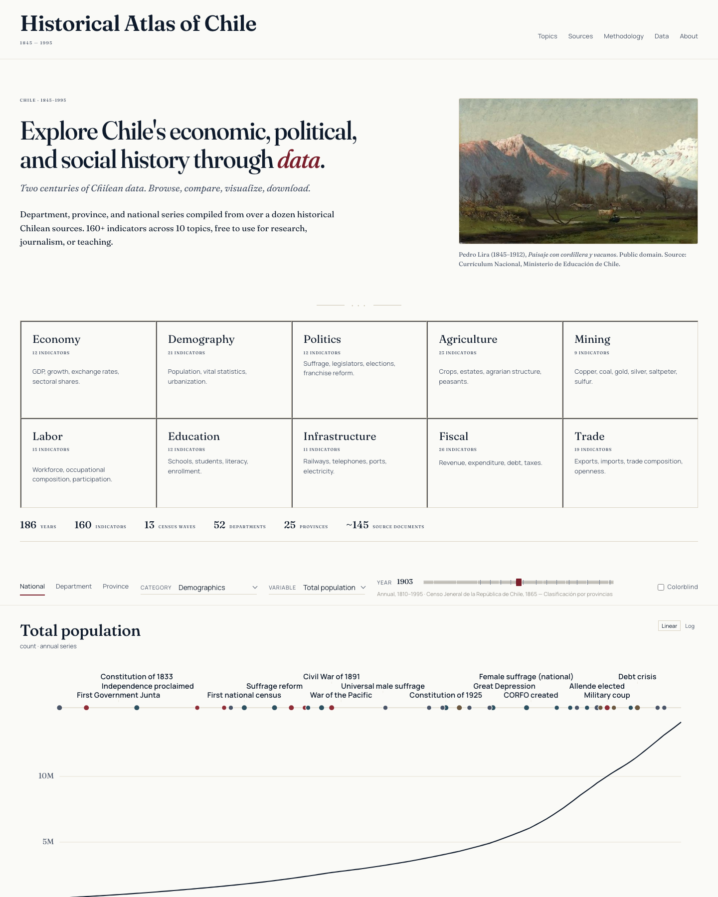
An interactive data explorer presenting subnational data at three geographic scales—national time series, department-level maps, and province-level maps. Browse, compare, visualize, and download over a hundred and sixty indicators across ten topics, compiled from more than a dozen primary sources.
160+indicators
10topics
1810–1990coverage
3scales